PyroLife International Symposium: Towards an Integrated Fire Management
Highlights from the second PyroLife Symposium on June 10, 2020 by Nemer Abusamha.
To prepare for unprecedented wildfires amplified by climate change, a lack of fuel management and vast urbanization, fire agencies, and managers use fire forecasting and risk prediction tools to improve decision making in wildland fire management.
- Over the last years, fire agencies and fire managers have faced unprecedented wildfires that require applied fire sciences with diverse other disciplines for them to make better decisions. Such integration produces operational tools and software for predicting wildfires hazard and to reduce wildfire risk.
- Operational wildfires software and applications provide integrated results from research such as historical fire risk analysis, fire behavior simulations based on empirical models, fuel models with real-time satellite data such as weather forecast, fuel spatial distribution, and topography.
- Examples of tools designed and developed based on fire science, industry, and diverse other disciplines include Wildfire Analyst. Beside desktop-based software, there are set of field phone applications such as WindNinja mobile.
Over the last years and decades, extreme wildfire events have afflicted communities to an unprecedented degree. Even though wildfire suppression has been successful in the past, the impact of climate change on fuel and weather conditions is predicted to reinforce extreme fire behavior. A lack of fuel management combined with the expansion and the intermix of urban settlements into vegetation zones (wildland-urban-interface, WUI), additionally increases the risk posed to lives, properties, and infrastructure to fire.
The emerging field of wildfire science integrates different disciplines such as social sciences, meteorology, and risk analysis. This will help to improve efficient decision making based on field operational tools for fire risk assessment, and support fire management in decision making and planning.
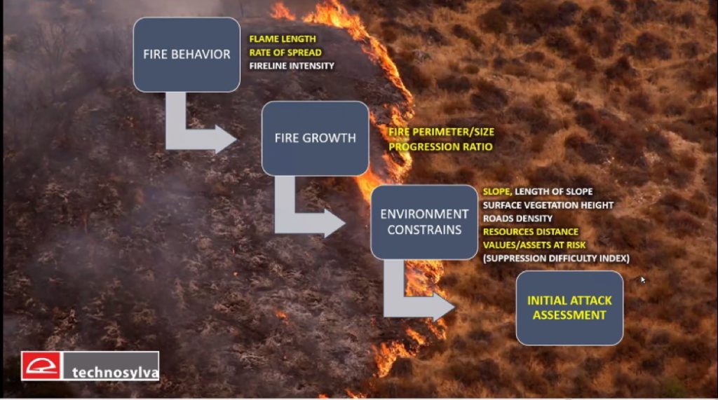
According to Adrián Cardil, a wildfire expert at Tecnosylva and researcher at the University of Lleida, wildfire risk forecasting tools are implemented for validation and improvement of fire forecasts. Fire science and wildfire research provide the base to build such operational applications and tools which can help to predict potential ignition locations, flame length, and the potential impact on structures and many other parameters relevant for decision making. Complemented with a real-time set of outputs, operational services can help to prepare for different wildfire scenarios under certain conditions.
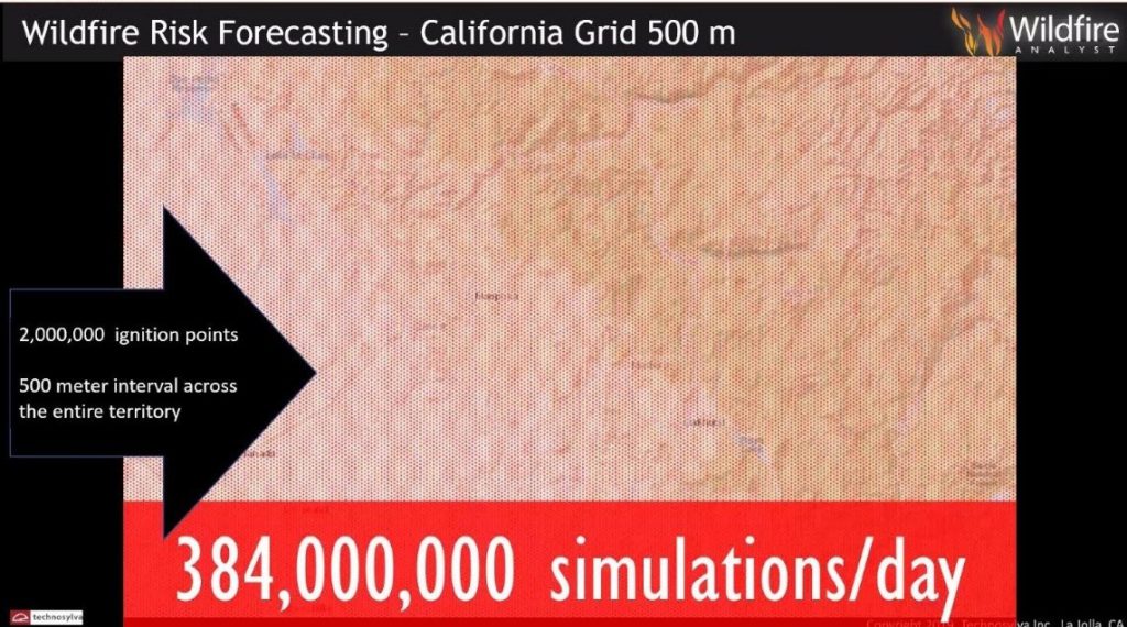
An example is the implementation of the FireCast tool for wildfire risk forecasting in the state of California. Near 400 million simulations run at each 500m interval are used for wildfire risk forecasting up to three days in advance. Simulations help to identify locations with a high probability of ignition, fire spread, and potential consequences. Thereby, FireCast helps all stakeholders to prepare for any possible wildfire in advance.

Adrián highlights that simulations of fire spread and behavior used at Technosylva are based on different quasi-empirical and empirical models such as Rothermel Surface Fire Spread. Empirical models are based on correlations and derived from experiences and gathered data. To improve forecasting and fire risk planning all wildfires operational tools must be based on applied fire sciences. In addition, the constant coupling of operational wildfires tools with wildfires scientific research is important to enhance fire management and decision making.

“Technosylva is a wildfire experts firm that provides advanced GIS-enabled software solution for wildfire protection planning, operational response and firefighter and public safety. Technosylva has a set of operational tools used in different countries and with different conditions.”


Leave a Reply